

Contents of this page may be automatically translated, we take no responsibility for the accuracy of the translation. Feel free to contact our customer support centre if you have any questions.
Reference data from the Swepos stations in the form of daily files are available free of charge. With them you can post-process your GNSS measurements with your own software.
Use our services
What is RINEX data – daily files?
You download data by yourself from our FTP server.
A RINEX file contains observations of the GNSS code and carrier phase signal, from a Swepos station. Each RINEX file contains 24 hours of observations. Metadata at the beginning of the RINEX file contains e.g. information about marker ID, GNSS antenna / receiver, approximate coordinates and measurement time.
RINEX hourly files are included with the Post-processing subscription.
How do I get data?
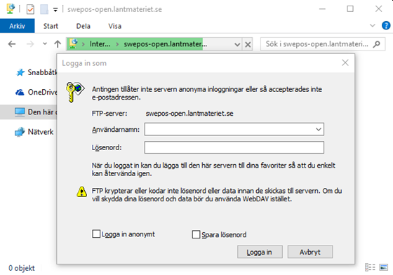
If you have a web account at Swepos' Service Portal (new window) you have access to Swepos' FTP server:
- ftp://swepos-open.lantmateriet.se/ (new window) or
- sftp://swepos-open.lantmateriet.se/ (new window). SFTP uses an encrypted connection.
When you log in, enter your username and password.
Only passive FTP is supported.
If you have a Windows computer, you can, for example, use Windows Explorer for FTP transfer. Any other FTP client of your choice also works fine. However, FTP transfer directly in the web browser is not recommended. To use SFTP connection, choose an FTP client that supports SFTP.
FTP server content and structure
This is the file and directory structure of the ftp server:
| Data type | Dirctory |
|---|---|
| Daily files, RINEX 3 | rinex3/year/day/ |
| Daily files, RINEX 2 | rinex2/year/day/ |
RINEX 3 files
The logging interval is 30 seconds.
The file names for data in RINEX 3 format consist of a given set of parameters,
nnnnxxccc_s_yyyydddhhmm_ppp_iii_tt.fff.gz
where the various parameters are described in the table below.
| File name parameter, RINEX 3 format | Description |
|---|---|
| nnnnxxccc |
Station ID, where
|
| s |
Data source, where
|
| yyyydddhhmm | File start time (year, day of year, hour, minute) |
| ppp | File length |
| iii | Logging interval |
| tt |
Data type, where
|
| fff |
File type, where
|
Read more about RINEX 3 at IGS website (new window).
RINEX 2 files
RINEX 2 is an older version of the RINEX standard, which does not support all GNSS signals currently available. Swepos continues to provide data in the RINEX 2 format until 2024-12-31. All existing RINEX 2 files will continue to be available from our archive.
The logging interval is 15 seconds.
Compared to the RINEX 3 files, RINEX 2 has files shorter names,
nnnndddp.yyt.zip
where the various parameters are described in the table below.
| File name parameter, RINEX 2 format | Description |
|---|---|
| nnnn | Station designation. Translation to station name can be found in the coordinate list (see below). |
| ddd | Day of the year |
| p |
Code for the length and start time of the file, where
|
| yy | Year |
| t |
File type, where
|
Information about the Swepos stations
When processing with your own software, you need information about the antenna type and eccentricities (antenna heights) of the Swepos stations.
In addition, accurate coordinates are needed for the stations. You can retrieve the coordinate list for a specific date via Download coordinate list at the e-service portal (new window).
Station information
Information about antenna type and eccentricities for the Swepos stations can be found in the e-service portal, Download coordinate list.
Some stations have several receivers why we have chosen to only report antenna type and not receiver type in the station information file. Receiver type appears in the RINEX files. Antenna type, coordinates and eccentricities are also present in the RINEX files, but the information is more reliable in the station information file.
The station information file uses marker name for the marker, as for some stations there is or has been more than one marker. Translation between marker names, file name designation and station name can be found in the coordinate list.
The antennas of the Swepos stations have a protective hood, so-called radome, which is referred to as "OSOD" or "OSOP" in the RINEX files. If your post-processing program does not recognize the radome designation, you can use "NONE" instead, as the influence of the OSOD and OSOP radomes is small.
Coordinates
You can retrieve the coordinate list for a specific date via e-service Download coordinate list, and save as an Excel or pdf file.
The coordinates are calculated with absolute antenna models. The station coordinates are checked continuously and, if necessary, updates are made, e.g. when replacing the antenna. When a station is new, or after an antenna change, preliminary coordinates are first calculated based on five 24-hour measurements.
Twice a year, updates are made to these so-called final coordinates. These are based on three weeks of data during spring or autumn. The time is chosen to minimize the effect of any seasonal variations and to avoid periods of snow on the antennas. Normally, the difference between preliminary and final coordinates is within 5 mm. Exceptions are if the preliminary coordinates are determined during a period of snow or if the station is not completely stable.
If you measured for a longer period, you are asked to take out a coordinate list at the beginning and end of the period. If the coordinates of a desired station differ between the beginning and the end of the period, it may be due to e.g. an antenna replacement.