

Contents of this page may be automatically translated, we take no responsibility for the accuracy of the translation. Feel free to contact our customer support centre if you have any questions.
Lantmäteriet collaborates with the Swedish Transport Administration, Trafikverket, and the Swedish Civil Contingencies Agency, MSB, to facilitate access to national geodata for emergency preparedness and emergency services. Together, we have developed a basis for a national common background map for emergency preparedness and emergency services.
Shared situational awareness requires a common background map
Often, emergency preparedness and emergency services need to collaborate across geographic and organizational boundaries. In such cases, it is important to have a shared situational awareness based on a common background map.
The background map is a crucial prerequisite for the actors to be able to locate, navigate, choose the best route, and carry out interventions effectively.
Recommendations for a national background map
The topographic web map serves as the base, available as a view service for online use, and as a download product for offline use. In addition to the topographic web map, there are recommendations of products that contain addresses, buildings, property divisions, place names, and elevation data.
The Swedish Civil Contingencies Agency, MSB recommends all emergency preparedness and emergency services to use a common national background map, containing a selection of products from Lantmäteriet.
Take part of:
- The selection of Lantmäteriet's products that constitute the national background map.
- The Swedish Transport Administration's package of traffic network data for emergency services, including information on roads and railways that can be used, for example planning and route selection (new window).
Products free of charge to ambulance- and rescue services
To make it easier for the Regions´ ambulance operations and Municipal rescue services, Lantmäteriet offers a selection of the recommended products free of charge.
Read more about the free geodata for ambulance- and rescue services.
Example on how the background map can look
Lantmäteriet´s e-servcice “Min karta" shows the topographic web map and orthophotos together with property division, addresses, buildings, place names and elevation data. The recommendations from the Swedish Civil Contingencies Agency, MSB indicate the products included in the national background map, to be used by the emergency preparedness and emergency services to create similar functionality as in the e-service “Min karta”.
Ensure access and timeliness
Emergency preparedness and emergency services need to install and combine the products and services in their systems to ensure that they always have access to the recommended background map, both online and offline. To keep the background map current, it is important that the actors update by downloading the latest version of the download products. The Swedish Civil Contingencies Agency, MSB recommends the actors to ensure both access and timeliness of the background map.
Read the recommendations on MSB's website (in Swedish, new window).
Lantmäteriet is working on a project that will provide a map base for civil preparedness, that is, crisis preparedness and civil defense. The map documents must be available for civil preparedness actors to download, print, store and distribute.
Access to common printed maps is a prerequisite for carrying out interventions in a situation when digital maps are not available. The printed maps constitute an additional resource and asset for civil preparedness to practice with and use when regular systems do not work.
National reference system for positioning
A common reference system is one of the foundations for actors of emergency preparedness and emergency services to be able to communicate the position of an event. The Swedish Civil Contingencies Agency, MSB recommends the national reference system SWEREF 99 TM and height system RH2000.
Municipalities ensure quality with “Blåljuskollen”
It is important that the background map is reliable and presents correct information, especially regarding objects and features that are important for emergency services to locate correctly. Being in the right place at the right time requires up-to-date municipal data.
Changes in our municipalities, such as new roads, buildings, and green areas, require municipalities to update their geodata and map information to keep it current.
Lantmäteriet, together with the Swedish Transport Administration, Trafikverket has developed a checklist called “Blåljuskollen” for the municipalities of Sweden. The checklist is designed for municipalities to quality-assure their geodata processes to create and update the information that emergency services need to locate correctrly. The Swedish Civil Contingencies Agency, MSB recommends that municipalities conduct “Blåljuskollen”.
Read more about “Blåljuskollen”.
Knowledge and ability to use geodata before, during and after an event
A shared situational awareness is a prerequisite for multiple actors to act coordinated during an event. Coordination places high demands on all involved parties having access to, being able to use and communicate geodata.
By increasing the knowledge and ability to use and communicate geodata, there are good conditions for coordination between actors before, during and after an event.
Take part of:
- How some municipalities have worked to increase the knowledge and ability to use geodata before, during and after an event (in Swedish, pdf, new window).
- Template for developing a strategy and action plan for the use of geodata in case of a crisis (in Swedish, pdf, new window).
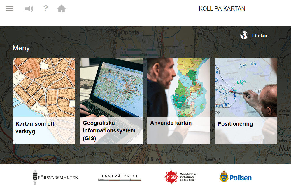
Know your map – ”Koll på kartan”
Know your map, “Koll på kartan” is a basic education on maps, geodata and geographic information systems (GIS) with the purpose of increasing the ability to use maps and geodata.
The training takes about 1 hour to complete and contains the following parts:
- The map as a tool
- Geographic information systems, GIS
- Use the map
- Positioning
Take part in the training "Koll på kartan" (new window).
The training is developed in collaboration with Försvarsmakten, Lantmäteriet, the Police and the Swedish Agency for Community Safety and Preparedness, MSB.
Nordic Geodata for Crisis Preparedness and Emergency Services
Crisis preparedness and emergency service actors can access a selection of cross-border geodata free of charge from the Nordic mapping agencies. The selection includes map data, addresses, and place names within an area covering a 100-kilometer zone from the neighboring country's border.