

Contents of this page may be automatically translated, we take no responsibility for the accuracy of the translation. Feel free to contact our customer support centre if you have any questions.
Sweden needs a common total defense map that can be used in peacetime crisis situations, heightened preparedness, and ultimately war. Therefore, Lantmäteriet wishes to make available the maps currently used by the Armed Forces, namely the National military map, NMK, for civil preparedness.
Need for common maps for civil preparedness
Civil preparedness entails preparing for all kinds of societal disruptions that pose a risk to us. An important prerequisite is access to and use of common maps and geodata.
The Swedish Civil Contingencies Agency, MSB, provides recommendations regarding a common digital background map for crisis preparedness on their website (in Swedish, new window). In situations where digital maps are not available, it is important to have access to common printed maps. Currently, civilian preparedness actors lack access to common printed maps.
Therefore, Lantmäteriet wishes to make available the maps that the Armed Forces currently use, namely the National military map (NMK), for civil preparedness.
Access to NMK for civil preparedness would mean that there is a common total defense map that can be used in peacetime crisis situations, heightened preparedness, and ultimately war.
Conditions for making NMK available for civil preparedness
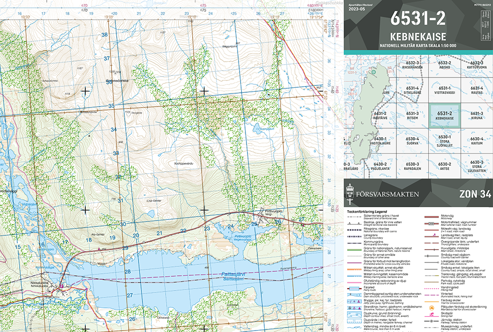
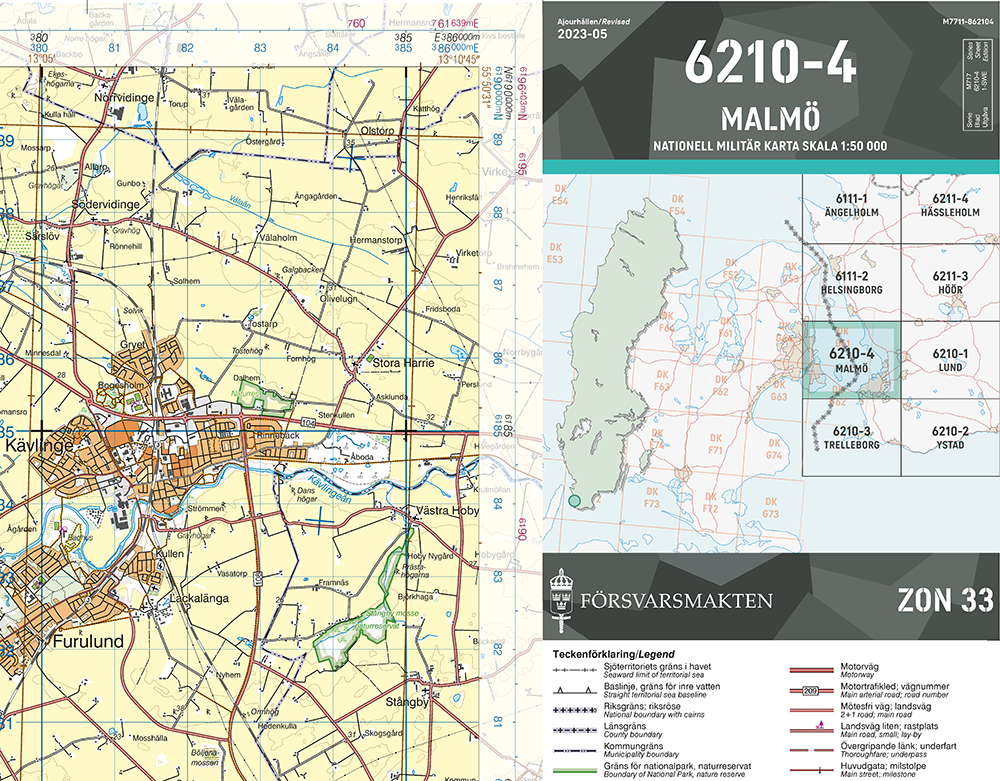
During the years 2023 and the beginning of 2024, Lantmäteriet has investigated the legal and economic conditions for making NMK50 and NMK250, that is, NMK at scales of 1:50,000 and 1:250,000, available for civil preparedness.
The starting point has been to make existing NMK available without changes. This would mean access to the same map bases that the military defense currently has. When Lantmäteriet can provide NMK, civilian preparedness actors can download and print the maps themselves.
The investigation has clarified data ownership, information security needs, agreements, users, contracts, and terms as well as costs. The work has also included the implementation of webinars and seminars with prospective users of NMK.
Access recordings from the webinar in November 2023 (all links open in a new window):
- Lantmäteriet as a preparedness authority and the Swedish Armed Forces' national military map, NMK.
- Need for common printed maps. How does NMK relate to Lantmäteriet's other products?
- What does NMK contain? What file formats are available?
- How the Swedish Armed Forces currently use the maps.
- Lantmäteriet is investigating the possibilities of making NMK available for civil preparedness.
The target audience for access to NMK within civil preparedness will be actors involved in civil preparedness who carry out public tasks in crisis preparedness and civil defense, including:
- Preparedness authorities according to Regulation (2022:524) on state authorities' preparedness
- State-owned companies with responsibilities in civil preparedness
- Regions
- Municipalities.
Lantmäteriet has now laid the groundwork to make NMK available, but there are still:
- Developing a provision via Lantmäteriet's self-service Geoportal and
- Securing funding for management and costs associated with the included information.
Currently, Lantmäteriet does not have funding to proceed with provision.
Format for printing and GIS
NMK covers the entire country and will be available in the following formats:
- Digital print files, i.e., image files, optimized for printing at a printing press or large format printer. The digital print files include legends, grids, and graticules.
- PDFs for printing in A3 format.
- Raster files in GeoTiff format. The raster files can be used in geographic information systems (GIS), allowing for the overlay of activity-specific and event-specific information and the creation of custom maps.
Training for those working in civil preparedness
"Koll på kartan" (only in Swedish) is a fundamental training on maps, geodata, and geographic information systems (GIS) aimed at enhancing the ability to use maps and geodata. The training has been developed in collaboration with the Swedish Armed Forces, the Police, and the Swedish Civil Contingencies Agency (MSB).
The training takes approximately 1 hour to complete and includes the following parts:
- The map as a tool
- Geographic Information Systems, GIS
- Using the map
- Positioning.
Access "Koll på kartan" training at MSB's website (in Swedish, new window).
Questions and answers about NMK
There is no launch date yet. Lantmäteriet still needs to develop and finance provision.
No, NMK contains data from other authorities with conditions and fees; therefore, NMK cannot be provided as open data.
Lantmäteriet produces new print files every year. However, NMK250 does not have many details updated.
The goal is for NMK to be downloadable from Lantmäteriet without charge.
No, Lantmäteriet does not print maps. Civil preparedness actors who will have access to NMK through agreements will be able to download the maps to print themselves.
Organizations with public tasks in crisis preparedness and civil defense, such as:
- Preparedness authorities according to the regulation (2022:524) on state authorities' preparedness
- State-owned companies with responsibilities in civil preparedness
- Regions
- Municipalities.
NMK will be used for public end-use within civil preparedness, i.e., when performing public tasks in crisis preparedness and civil defense.