

Contents of this page may be automatically translated, we take no responsibility for the accuracy of the translation. Feel free to contact our customer support centre if you have any questions.
Here we describe older coordinate systems that have been used in Sweden, in local or national applications.
Municipal plane coordinate systems
Before the introduction of SWEREF 99, a large number of different coordinate systems were used at the local level. The local systems were often of poor quality which, among other things, made the use of GNSS more difficult.
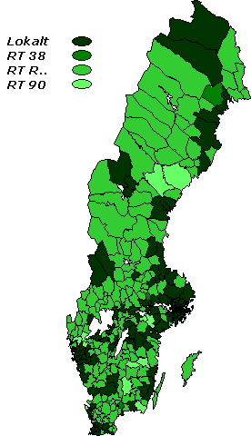
The municipal coordinate systems were based on local control networks that were often connected to the national reference network; usually RT 38 or one of the twelve regional systems (RT R01 – RT R12). Only in a few municipalities were the control networks connected to RT 90. In Lantmäteriet's system for handling geographic information, there were just over 200 sets of transformation parameters between RT 90 and local coordinate systems, which can be seen as an approximate estimate of the number of coordinate systems that have been used in Sweden.
It has become apparent that the local networks often had a slightly different geometry compared with the national reference network. In addition to the fact that local origins often had been defined, rotations and scale changes could also have been created, relative to the national network.
There were also several different coordinate systems within the same municipality, because the merging into larger municipalities which has taken place.
To create relationships between local plane coordinate systems and SWEREF 99, the RIX 95 project was carried out. By establishing a coordinate transformation between SWEREF 99 and the local system, GNSS measurements in the local coordinate system could be facilitated. It was also a springboard for replacing the local system with SWEREF 99. Local plane systems often contained distortions that made it difficult to use GNSS in the system, so the local systems needed to be geometrically corrected to obtain a homogeneous system that is well suited for GNSS measurements.
1000/1000-systems
For smaller communities, holiday home areas and similar, it has previously been common to use small local plane coordinate systems. These systems often lacked connection to superior coordinate systems, even though the internal geometry has been good.
The term "1000/1000-system" has arisen because an arbitrary point in the area is defined as (x = 1000, y = 1000), in order to avoid negative coordinates. This means that all measured points from the survey have both x and y coordinates of this order of magnitude.
To approximately connect the survey to a national coordinate system, an alignment has been made, using graphical details in a map or orthophoto. Such alignments can be of very low quality.
The 1000/1000 systems cannot be easily transformed into a municipal, regional or national coordinate system. To create a coordinate transformation to another coordinate system – for example SWEREF 99 (about the same as WGS 84) – there must be several points that have coordinates in both the local system and the other system.
Using GNSS surveys, relative to reference stations, it is now possible to connect these local coordinate systems to the national reference system at a reasonable cost.
European Datum
ED 50
In the years 1948–1951, the first coherent adjustment of Europe's triangle network was carried out. It was made on the International ellipsoid (Hayford's ellipsoid) with Potsdam as a starting point. The system was named European Datum 1950 or abbreviated ED 50. As a rule, ED 50 has been used together with the UTM map projection system.
ED 87
In the early 1950's, the RETrig (Readjustment of the European Trigonometric Networks) Commission was formed, for the task of improving ED 50 via new measurement data. The commission carried out a number of adjustments, the results of which were designated ED 77, ED 79 and finally ED 87. All ED solutions can therefore be considered as an improved ED 50.
ND 87
ND 87 is a Nordic reference system that was created because it was uncertain when the final ED 87 solution would be determined. The system was established since an urgent need for a well-defined and nationwide coordinate system, as a replacement for RT 38, emerged.
ND 87 can be seen as a temporary ED solution that covers only the Nordic countries. The system is also the basis for the development of RT 90.