Contents of this page may be automatically translated, we take no responsibility for the accuracy of the translation. Feel free to contact our customer support centre if you have any questions.
Here we answer questions concerning Lantmäteriet 's products in the field of image.
If you do not find the answer to your question, you are welcome to contact geodata support - we'll be happy to help you.
Questions and answers
An aerial image is a central projection, without correction for the shape of the terrain or the camera's rotations. This means that the scale in the image varies.An orthophoto is produced from aerial photographs. It has been corrected geometrically and put together into a correct image of the ground. Orthophotos are primarily used as a basis for producing maps.
They are delivered with the resolutions 0.15 m/pixel resp. 0.37 m/pixel. Previous vintages are delivered in the resolutions that existed then, ie. 0.24 m / pixel and 0.48 m/pixel.
Here we refer to orthophotos produced from aerial photographs taken from 2019.
They are delivered with the resolutions 0.16 m / pixel resp. 0.40 m / pixel, but they can be delivered in the resolutions 0.25 m / pixel (only those with original resolution 0.16 m / pixel), 0.5 m / pixel and 1 m / pixel.
Previous vintages are delivered in the resolutions that existed then, ie. 0.25 m / pixel, 0.5 m / pixel and 1 m / pixel.
Here we refer to orthophotos produced from aerial photographs taken from 2019.
They are available as black and white (black and white), color (RGB), IR (RGI) and also as 4-channel orthophoton (RGBI).
No, the index division is the same as before.
No, the distributions are the same as before; orthophotos with a resolution of 0.16 m/pixel are delivered in squares of 2.5 x 2.5 km and orthophotos with a resolution of 0.40 m/pixel are delivered in squares of 5 x 5 km.
No, they still have 8 bit color depth.
When we produce orthophotos from aerial photographs, corrections are made so that objects on the ground are placed in the right place. It is mainly at the edge of an aerial image, where an object is not seen straight from the top, that altitude differences affect the position in the image so that e.g. a house foundation can end up a little wrong.
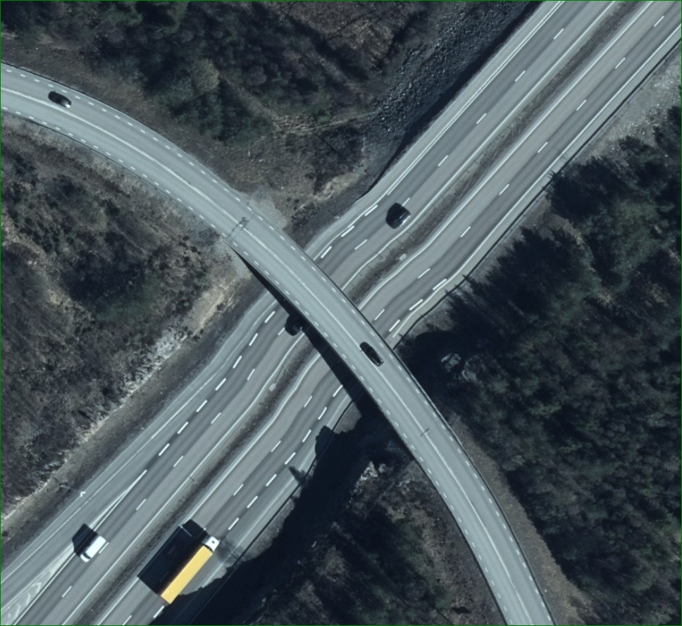
When it comes to bridges, it would look strange if we only adjusted the position correctly at ground level, the bridges would then look like hammocks. Therefore, we use height data from the height of the bridge and gradually adjust the height data to the ground level around the bridge. This leads to the bridge itself getting better, but the ground around the bridge can be deformed, see picture. If this deformation is a problem, stereo measurement can be done in aerial images, where this effect does not occur.
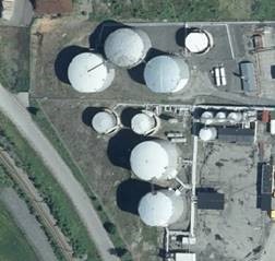
In the pictures you see e.g. both the cisterns and the houses seem to lean. Why do not the buildings become completely perpendicular to the viewer?
The effect is non-existent / small in the middle of the camera, but is larger at the edge of an aerial image. In the work of making scale aerial images, so-called orthophotos, we only adjust the phenomena at ground level (and many bridges) to the correct position, which means that roofs and treetops are not completely correct when they are on the edge of an aerial image. If you look at the base of the cisterns and house foundations, these are located correctly.
This is usually called a standard / traditional orthophoto and is the one provided by Lantmäteriet. A true orthophoto / true orthophoto tries to show things, even above ground level, straight from the top. This requires high-resolution 3D data and high-coverage images to be able to see the ground on all sides around the houses. Today it is possible to produce 3D data with the help of image matching, but the result is not always good. Today, Lantmäteriet also does not take pictures with as high a coverage as is required for this, among other things due to that it is more resource-intensive to take aerial photographs with higher image coverage and that the amounts of data to handle and store will be larger.
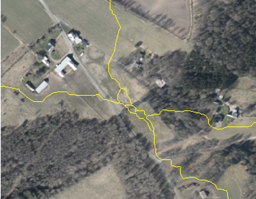
During the generation of aerial image seams, which takes place automatically, loops and islands sometimes appear in the seams. These usually cause no or very little blurred effects in the orthophotos.