

Contents of this page may be automatically translated, we take no responsibility for the accuracy of the translation. Feel free to contact our customer support centre if you have any questions.
You can order point descriptions, point maps, coordinate and benchmark data from from the geodetic archive. Coordinate transformations are also found in the archive.
Use our services
The contents of the archive
 The extensive geodetic archive contains information on the points of the Swedish national reference networks such as point identity, marking, coordinates, heights and gravity, as well as measurements and calculations that have been made for this purpose.
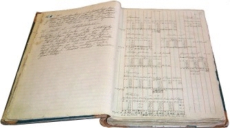
The Geodetic Archive as a whole contains documents from the end of the 18th century to the present.
| Object type | Quantity |
|---|---|
| SWEREF points, class 1 in SWEREF 99 | 400 |
| RIX 95 points, class 2 in SWEREF 99 | 10 000 |
| Triangulation points, class A, from the third triangulation | 4 000 |
| Triangulation points, class B, densification of the third national triangulation | 300 |
| Triangulation points, Class C, not intended for geodetic frame measurement | 1 000 |
| Older triangulation points | 12 000 |
| Flight signaling horizontal ground control points | 8 000 |
| Astronomical points | 200 |
| Height benchmarks from the third precision levelling, RH 2000 | 50 000 |
| Older height control points | 70 000 |
| Barometric height control points | 6 000 |
| Gravity points | 20 000 |
| Calculation manuscripts and measurement protocols | 10 000 |
| Point and network maps | 5 000 |
The Digital Geodetic Archive
Some of the material from the modern coordinate and elevation systems is available in the Digital Geodetic Archive and contains almost 50,000 height benchmarks and 10,000 horizontal control points (so-called SWEREF and RIX 95 points).
You can access the information via our services:
- Hitta stompunkt (roughly translated as Find Geodetic Control Point) is an e-service where you can find point descriptions as well as coordinate and height lists. No login required.
- Stompunkt visning (Geodetic Control Point Viewing Service) allows you to see the geodetic control points in your own GIS application along with other data you are working with.
- Stompunkt direkt (Geodetic Control Point Direct Access Service) is intended for machine-to-machine communication and is suitable for you who want to use a service in your own systems.
You can also access the information by contacting the geodesy department.
Provide information about our ground control points
You can report if you have found again one of Lantmäteriet's ground control points, if a point has been destroyed, or if a point description contains incorrect information.
Let us know that the information in the archive needs updating.