

Contents of this page may be automatically translated, we take no responsibility for the accuracy of the translation. Feel free to contact our customer support centre if you have any questions.
A view service in accordance with the EU directive INSPIRE that presents property information from Lantmäteriet’s basic data store. The map information is separated into 13 layers. The product name in Swedish is Fastighetsindelning Visning.
About this product

A view service in accordance with the EU directive INSPIRE.
For each of the layers in the service there is one or more pre-defined presentation methods, called styles. By changing style for a layer, you can affect how the information is presented.
Maintenance and update frequency
The property classification is updated continuously by the Land Survey authorities in connection with property formation. Some municipal Land Survey authorities update this information periodically, which means that they submit changes monthly. It usually takes an hour for an update to become visible in the service.
Want to know more about why you can´t always trust the property borders displayed on the map?
Availability
Our geodata services are normally available 24/7 and we provide support during working hours. Read more about availability to geodata services.
Services that meet the INSPIRE specifications can be evaluated on www.geodata.se/geodataportalen (new window). There you can also find detailed information about the services.
On the INSPIRE website (opens in new window), you can read the implementing rules that form the basis for our INSPIRE services.
Presentation of the information layers
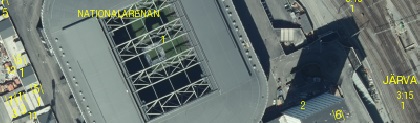
All example images show the different layers with Topographic web map View Service or Orthophoto View Service.
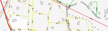
Property boundary
The layer contains:
- Territorial, national, county, municipality, district, neighbourhood area and property boundaries.
- County, municipality, district and property boundaries JB 1:5,
- Boundary for three-dimensional spaces.
- Property shoreline.
- Enclosing line for real property boundary.
- Enclosing line for real property boundary JB 1:5.
- Civil parish name boundary (Gotland).
- Civil parish name boundary JB 1:5 (Gotland).
- Line-displayed joint properties.
- Dovetail symbol for property.
- Small dovetail symbol for property.
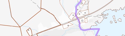
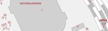
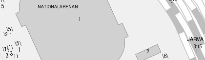
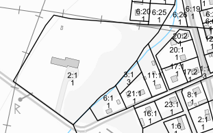
Example image in scale 1:15 000, style with a light background.
Example image in scale 1:15 000, style with a dark background.
Example image in scale 1:15 000, in the style of the cadastral index map.
Property boundary, quality
The layers contents are the same as in the layer Property boundary, but the information is presented thematically from mean errors.
Example image in scale 1:4 000.
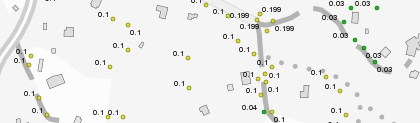
Property boundary, mean error
The layer presents the positional accuracy for boundaries. The mean error of the position is printed on each boundary line.
Example image in scale 1:4 000.
Standalone fishing
The layer contains:
- Fishing area boundaries.
- Line-presented land register fishing, special fishing lot and fishing community.
- Point-presented land register fishing, special fishing lot and fishing community.
- Enclosing line for fishing.
- Register number for fishing.
- Fishing area.
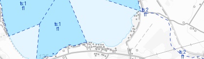
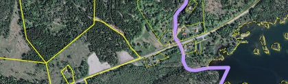
Example image in scale 1:30 000, styled with a light background.
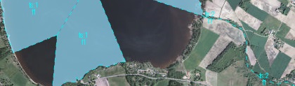
Example image in scale 1:30 000, styled with a dark background.

Example image in scale 1:30 000, in the style of the cadastral index map.
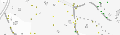
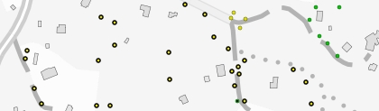
Boundary point
The layer contains international cairns, property boundary points and insurance marking.
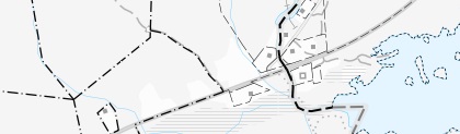
Example image in scale 1:3 500, styled with a light background.
Example image in scale 1:3 500, styled with a dark background.
Example image in scale 1:3 500, in the style of the cadastral index map.
Boundary point, quality
The layers contents are the same as the layer Boundary points, but the information is presented thematically from mean errors.
Example image in scale 1:4 000, in quality style.
Example image in scale 1:4 000, in improved quality style.
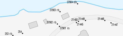
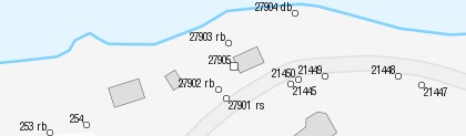
Boundary point, mean error
The layer presents the position accuracy for boundary points. The mean error in the position accuracy is printed on each boundary point.
Example image in scale 1:4 000.
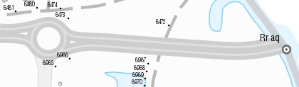
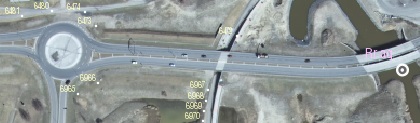
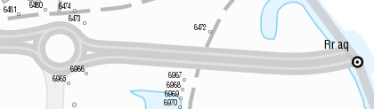
Boundary point, text
The layer contains serial numbers, marking types for property boundary points, insurance marking and “Rr” and serial numbers for international cairns.
Example image in scale 1:2 000, styled with a light background.
Example image in scale 1:2 000, styled with a dark background.
Example image in scale 1:2 000, in the style of the cadastral index map.
Text
The layer contains :
- Municipality names, only on municipality exclaves.
- District and neighbourhood names.
- Register numbers.
- Register numbers in brackets (shared properties).
- Register numbers in parentheses (properties with an uncertain location).
- Register numbers for three-dimensional spaces.
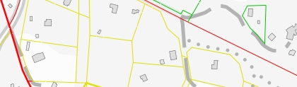
Example image in scale 1:3 600, styled with a light background.
Example image in scale 1:3 600, styled with a dark background.
Example image in scale 1:3 600, in the style of the cadastral index map.
Other administrative division
The layer contains:
- Civil parish boundaries.
- Civil parish names, only on civil parish exclaves (SN).
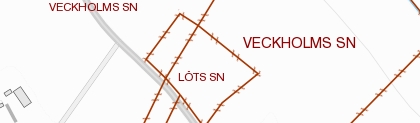
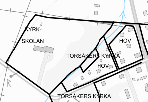
Example image in scale 1:7 500.
Cadastral parcels
The layer contains surfaces for properties and municipalities as well as property designations.
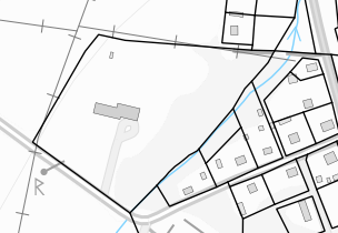
Example image in scale 1:5 000.
Cadastral zoning
The layer contains surfaces for districts and municipalities as well as district names.
Example image in scale 1:5 000.
Cadastral boundary
The layer contains property boundaries, neighbourhood boundaries, civil parish boundaries, district boundaries, municipality boundaries, county boundaries and country boundaries.
Example image in scale 1:5 000.
Documentation
Different versions of the services can overlap, so pay attention to which version you use. Version history describes the changes that occurred with each update.
| Version and date | Change since last version |
|---|---|
|
Version 1.2 New version |
Expanded by three layers for property division that meets the requirements for the EU directive INSPIRE. The service is supplemented with GetLegendGraphic for easier legend access. The quality presentation of property boundaries and boundary points is supplemented with four classes. The service now provides the possibility to choose between four or six quality classes. |
|
Version 1.1.2 Discontinued 2018-10-24
|
The quality marking of boundary points’ and property boundaries’ mean errors is expanded by two levels and the interval is adjusted. Because of this, the colour palette for the levels has been expanded with two new colours. |
Technical framework and standard for view services
Our map and image view services are based on the standardized call interfaces Web Map Service (WMS) and Web Map Tile Service (WMTS) developed by The Open Geospatial Consortium (OGC). WMS is also an ISO standard (ISO 19128).
The Open Geospatial Consortium website (new window)
The services are of the nature 'question-answer', where the consumer (user's system) sends a service call over the Internet and receives a map image in a standard image format or in a vector format for certain types of services.
The characteristics of the map image are defined by the call parameters, such as information type, geographical spread, reference system, image format and image size.
There are many client applications for display services or components for integration into own system available. In addition to commercial products, there are a number of established products based on open source code, such as QGIS.
At OSGeo, The Open Source Geospatial Foundation you can read more about software in the field of geodata that are based on open source code.
Do you want deeper technical information about our geodata products you can read the product documentation.
Our geodata products with API:s require that you have an application or software capable of managing the services. To view real property information or maps directly in your browser, you can use Lantmäteriet's e-services.
Order product
You can order geodata products directly from us or from one of our resellers.
Order from Lantmäteriet
If you want to order directly from us at Lantmäteriet you should use the Order form.
To use our geodata products, you need a license for use.
In the order form, you can both order geodata products and apply for a license agreement.
Order from resellers
If you need help with ordering our geodata products or get a customized solution for your business, you can contact one of our geodata resellers.