Contents of this page may be automatically translated, we take no responsibility for the accuracy of the translation. Feel free to contact our customer support centre if you have any questions.
Sometimes a map can be perceived as exact, and the property formation has a legal probative value. This is a misunderstanding and on this page we explain why.
Find your boundaries
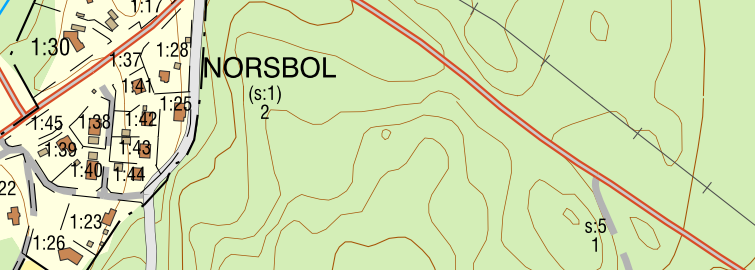
The coordinates and the sharp lines on the map give the impression of preciseness, despite this the property boundaries are not always displayed correctly and are not legally applicable. This means that you should not refer to the boundaries displayed on map if you want to build, fell trees, or perform other measures on a property.
Large variations in accuracy
The property division on the map are topical but the property boundaries have been created over a long period of time with varying methods. Because of this the boundaries that are visible on the map have large variations in positional accuracy, from five centimetres to a mean error of tens of metres.
According to the law the boundary marker on the ground defines the boundary. You can find more information about a property’s boundaries and other rights in a cadastral procedure document. A joint property unit that exists in the cadastral procedure document may not be visible on the digital map, for example. Read more about cadastral procedure documents on the page Cadastral procedure archives.
A short history
During the summer of 2011, the last borders in the Swedish mountains were digitized. Thus, the digital property division became complete. The work to supplement, update and improve the quality of property information is ongoing.
How the production of the property division started
History hints at what we mean by “the property map is partially built upon analogue maps with varying quality”. Allow us to take a short historical trip that describes the collection work.
In the year 1628 Anders Bure was assigned with creating the Swedish land survey. The assignment was to measure and establish maps over all of Sweden’s farms and villages, towns, industries, harbours and mines, as well as overview maps of civil parishes, hundreds and provinces.
The economic map
With the technological advancements of aerial photography, the Swedish National Mapping authority (RAK) started the production of the economic map in the year 1935. The nationwide geodetical system RT38 was introduced and a mapping plan for Sweden in the scale 1:10 000 was established. RAK borrowed cadastral dossiers from Lantmäteriet’s archive, and the cadastral maps were reduced to a scale of 1:10 000.
The property division was then constructed based on civil parishes by matching the reduced maps to the topography with the assistance of aerial photographs. The originals where then handed out to the land survey offices in each county for updates of the property division. The offices used different methods for this, which caused the quality to vary in the long run.
A more accurate map
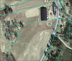
During the end of the 1960’s, orthophoto technology (scale aerial photographs) were introduced and a more accurate economic map started to take shape. The older maps were gradually revised – the property accounting on the map was manually matched to the orthophotos with a so-called boundary transfer. This improved the boundaries geometrical accuracy but simultaneously introduced errors when transferring boundaries from older sources.
Digital methods of production
In 1992 the government assigned Lantmäteriet utilizing all of its resources to create a nationwide digital database, which would match the economic maps’ contents. The map sheets that did not previously exist where produced with modern digital photogrammetry technology while existing original maps’ property boundaries were digitized by hand. In some cases, these digital boundaries were adapted to new orthophotos.
A consequence of this mixed production method is that many of the countryside boundaries in today’s digital property map are arbitrary. The boundary points’ positional precision varies considerably, with a mean error up to tens of metres. The metadata does not always reflect the actual quality because the boundaries are, in many cases, specified with a standard value for positional precision.