

Contents of this page may be automatically translated, we take no responsibility for the accuracy of the translation. Feel free to contact our customer support centre if you have any questions.
Topographic web map Download, raster, is suitable to use when you require a zoomable map but do not have the opportunity to connect to Lantmäteriet’s viewing services. The product name in Swedish is Topografisk webbkarta Nedladdning, raster.
About this product
The product provides access to a topographic web map that is adapted for display on a screen. The map has the same contents and appearance as the Topographic web map View Service, cache and has a harmonised cartography between the scales.
The map is provided in colour of as a toned-down map image. The information in the Topographical web map Download, raster comes in two variants. See a brief presentation of the contents below.
Geographical selection: Cut-out with min/max-coordinates, Sweden
Delivery formats: GeoPackage
Coordinate systems: SWEREF 99 TM (EPSG:3006), WGS84 Web Mercator (EPSG:3857).
Topographic web map Download, raster
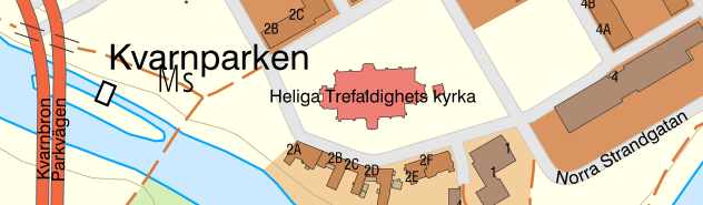
Topographic map information such as administrative divisions, buildings, facilities, regulations, roads, railways, mountain information, electricity transmission lines, ground surfaces, water surfaces, height contours, and terrain shading, place names, informational text and addresses.
The contents are presented in colour to create contrast.
Topographic web map Download, raster toned-down
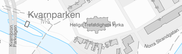
Topographic map information presented in a toned-down greyscale.
Maintenance and update frequency
The information is updated with different intervals depending on the type of information and scale level. A simplified description of the topicality of the information is that:
- The information in scale areas up to 1:15 000 is updated at least every 24 hours.
- The information in scale areas1:15 000 – 1:60 000 is updated every week.
- The information in scale areas over 1:60 000 is updated every month.
Documentation
For a more in-depth description of the contents, see the product description.
Demo data
To judge how this data works one must have access to a suitable management program, ArcGIS or QGIS for example.
On the page Demo data there are two areas. One area in an urban environment in Majorna, Gothenburg and one area in a forest environment along Emån.
Order product
You can order geodata products directly from us or from one of our resellers.
Order from Lantmäteriet
If you want to order directly from us at Lantmäteriet you should use the Order form.
To use our geodata products, you need a license for use.
In the order form, you can both order geodata products and apply for a license agreement.
Order from resellers
If you need help with ordering our geodata products or get a customized solution for your business, you can contact one of our geodata resellers.