

Contents of this page may be automatically translated, we take no responsibility for the accuracy of the translation. Feel free to contact our customer support centre if you have any questions.
The national boundary on land between Sweden and Norway runs from the western shore of Idefjorden in Bohuslän up to Treriksröset. This border is the longest on land in Europe. It is approximately a total of 1620 kilometres long and runs through very varied landscapes.
The nature of the boundary
The southernmost part of the national boundary between Sweden and Norway from Idefjorden up to northern Värmland can be described as a historical cultural border. It has a lot of natural geographical elements such as lakes and streams, in which the national boundary goes in curved lines. It is only in this southern part that such lines occur. The northernmost part follows close to the watershed as a geometric construction of straight lines, while the middle part has a mixture of the different characters. An approximate distribution over the habitat types the boundary crosses is:
- 860 km of bare mountains
- 570 km of forest and bush areas
- 170 km of lakes and streams
- 20 km cultivated land.
Mentioned already in the 11th century
The national boundary between Sweden and Norway is mentioned as early as the 11th century in the saga of Saint Olaf. The Bohuslän section of the boundary was established in 1661 through something called the Nasselbacka Treaty, which is mainly based on the peace in Roskilde in 1658. The remaining part of the boundary all the way up to Treriksröset is dealt with in the detailed Strömstad treaty from 1751. This treaty, incidentally, also deals with a large part of the current national boundary between Norway and Finland.
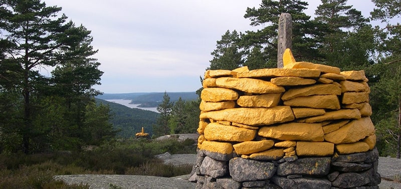
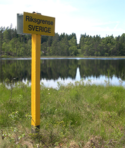
National boundary markers define the border
During the boundary demarcation that followed after the Strömstad Treaty, 293 boundary markers were erected. These have during boundary reviews over the centuries been supplemented with new markers, and some have also been removed. After the review 1984–1987, there are 642 markers and 11 unmarked breakpoints in the official designation series. Of the 642 markers, 612 are cairns, some of which are more or less constantly under water. The other 30 markers are mainly marked by natural stones, memorial monuments and wooden poles (with sign).
Review of the national boundary
A review of the national boundary between Sweden and Norway 2020–2024 is currently underway. You can find more information about this project in the menu.