
 Geotorget product support
Contents of this page may be automatically translated, we take no responsibility for the accuracy of the translation. Feel free to contact our customer support centre if you have any questions.
In this guide, we convert a surface model file in LAZ to a raster elevation model in TIFF using PDAL. Converting the file in this way makes it much easier and faster to work with the surface model.
We will use Point Data Abstraction Library (PDAL), which is a program that can be used to set up point cloud processing processes.
With PDAL, it is possible to implement many different functions by adding filters. It can also be used on laser data.
Guide - convert surface model from laz to tiff
- Download and unpack demodata (zip)
- Install Conda (python 3.7) on anaconda.com (new window)
- Start "Anaconda prompt"
- Install PDAL with conda install -c conda-forge pdal python-pdal gdal
- From the same directory as the surface model file, run :
pdal info --summary y650_56_2575_u19.laz { "filename": "y650_56_2575_u19.laz", "pdal_version": "2.0.1 (git-version: Release)", "summary": { "bounds": { "maxx": 569999.875, "maxy": 6504999.875, "maxz": 135.5499927, "minx": 567500.125, "miny": 6502500.125, "minz": -401.4400073 }, "dimensions": "X, Y, Z, Intensity, ReturnNumber, NumberOfReturns, ScanDirectionFlag,EdgeOfFlightLine, Classification, ScanAngleRank, UserData, PointSourceId, Red, Green, Blue", "num_points": 99986059 } } - Convert 0.25 cm / pixel 2019 surface model with 'pdal translate', but put the lower left corner to get the right georeferencing:
pdal translate --writers.gdal.resolution=0.25 --writers.gdal.radius=0.1 --writers.gdal.output_type=min --writers.gdal.width=10000 --writers.gdal.height=10000 –-writers.gdal.origin_x=567500 --writers.gdal.origin_y=6502500 y650_56_2575_u19.laz y650_56_2575_u19.tif - The tiff file format can then be used very quickly and easily. The image below shows part of it when it is opened in QGIS and display is set as terrain shading.
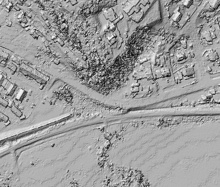
Surface model transformed into a tiff and visualized in QGIS.
More information about the surface model can be found at The product page for Surface model from aerial photos on lantmateriet.se . Please note that from 2019, the surface model has changed both the resolution and how the colors are stored.