
 Geotorget product support
Contents of this page may be automatically translated, we take no responsibility for the accuracy of the translation. Feel free to contact our customer support centre if you have any questions.
The guide shows examples of how to convert a surface model file (LAZ) to a true ortho and a DEM (GeoTIFF) with FME.
The example is in the file Surface ModelLazTillTiffDEMOchTrueOrtho.fmw.
Guide - Convert a Surface Model File to a True Ortho and a DEM
Do this in FME (tested in version 2019.2):
- Add a LAS reader that can load the surface model file and two GeoTIFF printers where the result should end up.
- Add an Image Raster izer-transformer.
- Edit Image Raster izer-transformer parameters as shown below.
- Add a Raster DEMGenerator and edit its parameters according to the example below.
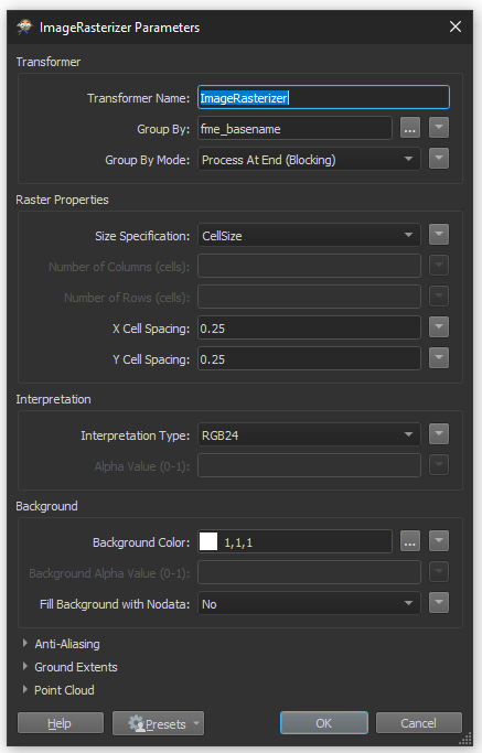

Step 3 - edit the parameters of Image Rasterizer transformers. Click on the image to see it larger. 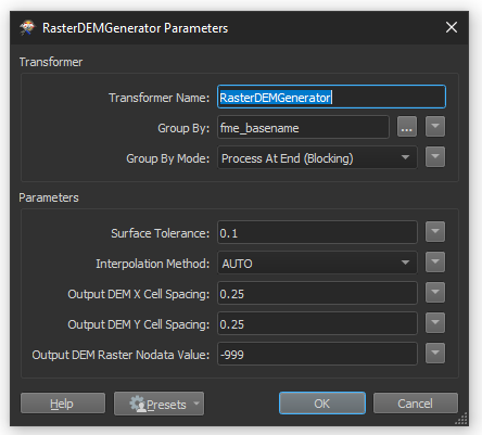
Step 4 - add a RasterDEMGenerator and edit its parameters. Click on the image to see it larger.
Surface tolerance
We have tested with Surface Tolerance = 0. It worked but it took a long time to run the data. The more this figure is raised, the faster it is possible to run data, but at the same time it provides a more generalized height model.
It took an hour and 17 minutes to drive data with Surface Tolerance value 0 on an older laptop:

Click on the image to see it larger.
It took 19 minutes to run data with Surface Tolerance 0.1 on an older laptop:

Click on the image to see it larger. - Tie all the transformers together and run the spinner. For example, it can give this result:
Dem (GeoTIFF):
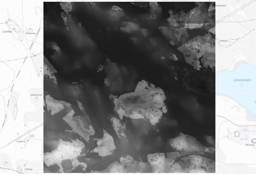
Example results: DEM (GeoTIFF). Click on the image to see it larger. True ortho:
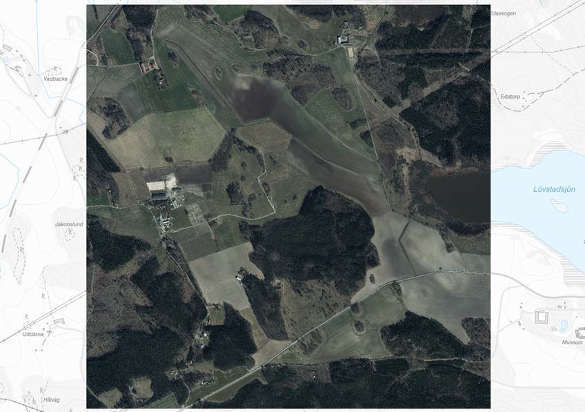
Example of result: true ortho. Click on the image to see it larger.