


Contents of this page may be automatically translated, we take no responsibility for the accuracy of the translation. Feel free to contact our customer support centre if you have any questions.
A display service according to the EU INSPIRE directive for the themes Administrative units, Address, Building, Land cover and Place name. The service also contains layers for the themes Hydrography and Transport that do not fulfil INSPIRE.
About this product

The service is developed within the Europe-wide geodata project European Location Framework (ELF).
The cartography in the service follows ELS specifications and information is displayed in a scale range larger than 1:72 200, with exception for Administrative units which is displayed in a scale larger than 1:500 000.
Maintenance and update frequency
The information is updated continuously. For more information, see the product description for Topography 10 Download, vector (in Swedish, pdf, new window).
Availability
Our geodata services are normally available 24/7 and we provide support during working hours. Read more about availability to geodata services.
Services that meet the INSPIRE specifications can be evaluated on www.geodata.se/geodataportalen (new window). There you can also find detailed information about the services.
On the INSPIRE website (opens in new window), you can read the implementing rules that form the basis for our INSPIRE services.
Presentation of the information
Information layers Addresses, Geographical Names, Building, Administrative Boundary, Administrative Unit and Land Cover Unit meet the requirement for view services according to the EU Directive INSPIRE.
Addresses
Layer for addresses, displayed on a larger scale than 1:2 000. This theme meets the requirements for view service according to the EU Directive INSPIRE.
Geographical names
Layer for geographical names, displayed on a larger scale than 1:72 200. This theme meets the requirements for view service according to the EU Directive INSPIRE.
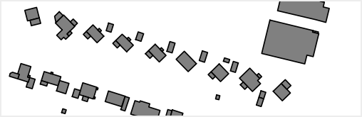
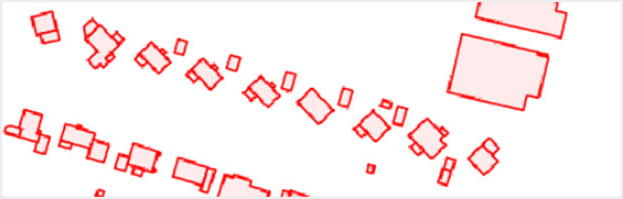
Building
Layer for buildings, presented with two styles and displayed on a larger scale than 1:18 100. This theme meets the requirements for view service according to the EU Directive INSPIRE.
Administrative boundary
Layer for administrative boundaries (municipality and municipality names). Displayed on a larger scale than 1:500 000. This theme meets the requirements for view service according to the EU Directive INSPIRE.
Administrative unit
Layer for adiminstrative units, displayed on a larger scale than 1:500 000. This theme meets the requirements for view service according to the EU Directive INSPIRE.
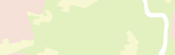
Land cover unit
Layer for land cover, displayed on a larger scale than 1:72 200. This theme meets the requirements for view service according to the EU Directive INSPIRE.
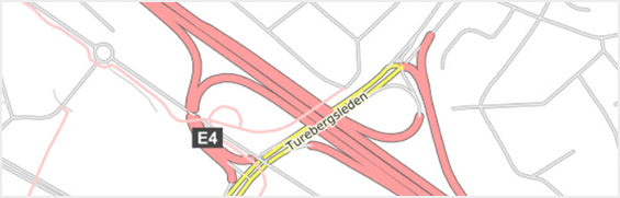
Road link
Layer for roads and cycle paths, including road numbers and road names, displayed on a larger scale than 1:72 200.
Railway link
Layer for railway, displayed on a larger scale than 1:72 200.
Ferry crossing
Layer for ferry, displayed on a larger scale than 1:72 200.
Runway area
Layer for runway for air traffic. Displayed on a larger scale than 1:72 200.
Hydrography
Layer for hydrography, displayed on a larger scale than 1:72 200.
Documentation
Different versions of the services can overlap, so pay attention to which version you use. Version history describes the changes that occurred with each update.
Technical description - Current version 1.0 (pdf, new window).
| Version and date | Change since previous version |
|---|---|
| Basemap View, Inspire Version 1.0 Available in Production environment: 2021-10-01
|
The service has changed name and access point. The Inspire graphical profile has been added for building, geographical names and land cover Some layers have been combined, hydrography and roadlink for example. |
|
ELF Basemap, View Discontinued 2021-12-31 |
Technical framework and standard for view services
Our map and image view services are based on the standardized call interfaces Web Map Service (WMS) and Web Map Tile Service (WMTS) developed by The Open Geospatial Consortium (OGC). WMS is also an ISO standard (ISO 19128).
The Open Geospatial Consortium website (new window)
The services are of the nature 'question-answer', where the consumer (user's system) sends a service call over the Internet and receives a map image in a standard image format or in a vector format for certain types of services.
The characteristics of the map image are defined by the call parameters, such as information type, geographical spread, reference system, image format and image size.
There are many client applications for display services or components for integration into own system available. In addition to commercial products, there are a number of established products based on open source code, such as QGIS.
At OSGeo, The Open Source Geospatial Foundation you can read more about software in the field of geodata that are based on open source code.
Do you want deeper technical information about our geodata products you can read the product documentation.
Our geodata products with API:s require that you have an application or software capable of managing the services. To view real property information or maps directly in your browser, you can use Lantmäteriet's e-services.
Order product
You can order geodata products directly from us or from one of our resellers.
Order from Lantmäteriet
If you want to order directly from us at Lantmäteriet you should use the Order form.
To use our geodata products, you need a license for use.
In the order form, you can both order geodata products and apply for a license agreement.
Order from resellers
If you need help with ordering our geodata products or get a customized solution for your business, you can contact one of our geodata resellers.