

Contents of this page may be automatically translated, we take no responsibility for the accuracy of the translation. Feel free to contact our customer support centre if you have any questions.
Take part in articles with examples of projects where we have contributed to achieving the goals in Agenda 2030. The articles were written in the autumn of 2021.
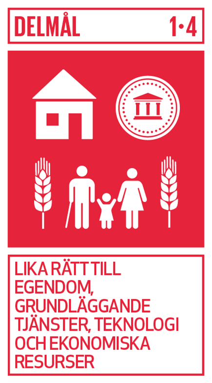
Economic impact
Through efficient, legally secure property formation, Lantmäteriet creates the conditions for sustainable growth in Swedish society. It lays the foundation for secure property ownership and contributes to a stable economy.
Securing ownership is the foundation of a market economy and a functioning credit market. This is obvious in Sweden but is missing in many parts of the world. Uncertain or no boundaries for real estate are a major source of concern and war in the world. Therefore, Lantmäteriet's mission is important to secure Sweden's properties.
Lantmäteriet contributes to sub-goal 1.4 through their services in several ways:
- In case of uncertainty about where a property boundary goes, Lantmäteriet can make a legally binding decision on the location of the boundary through a boundary determination. Ownership is established and the property owner can use the property with the certainty that they do it on their own land.
- Lantmäteriet has registers of owners and holdings for all approximately 3.5 million properties in Sweden, which provides legally secure and secure ownership and is a prerequisite for lending with properties as collateral.
- Lantmäteriet can also decide on community facilities that, among other things, meet the common needs of several properties for roads, water and broadband.
Görgen Hellman, unit manager at the Property registration, explains that the property registration makes you feel safe with your ownership, has the opportunity to take out a loan with the property as security and that rights that are registered on the property are secured.
- If, for example, you share a well or driveway with the neighbor and it is on the neighbor's property, then the next owner also has the same right if you sell. The condition is that an easement has been established, which is then linked to the property and not to the owner, says Görgen.
A large number of real estate transactions are carried out daily and for the credit market in Sweden to function, it is important that Lantmäteriet 's property register is current, correct and that changes are registered promptly.
- If the property register becomes obsolete, it can lead to important information is missing, which can lead to real estate transactions being wrong or carried out on incorrect grounds, says Görgen.
Görgen further explains that Lantmäteriet constantly works for a simple and secure process for mortgages, deeds and mortgage deeds. As far as the legislation allows, customers are offered digital services and automated decisions.
Smarter community building process
Smarter community building process aims to create a simpler, more open and more efficient planning and construction process that benefits citizens, businesses and other actors.
Malin Klintborg, task leader for the Smarter Community Building Process, explains that the work with digitalisation is linked to sustainable urbanization, but above all by creating inclusion and the same conditions for sustainability issues regardless of where in the country one lives.
- In the work with a Smarter community building process, we ensure that all municipalities, large and small, become part of a standardized digital exchange of socially important geodata.
A first step is digitized detailed plans that all follow the same standard. Malin further explains that digitized detailed plans, among other things, open up to be able to use digital methods to ensure that attributes such as green areas, water supply and outdoor areas are included in the plans.
- Digitized accessibility-adapted government data also entails inclusion by: the information can be accessed with various digital aids.
Background
The public construction sector is Sweden's single largest sector and affects the entire built environment. Lantmäteriet has been commissioned by the government to work for a smarter community building process. The first step towards a smarter community building process is national access to geodata which, among other things, gives developers, authorities and other stakeholders access to a coordinated digital process that will make it easier to plan for new housing, green infrastructure and climate adaptation.
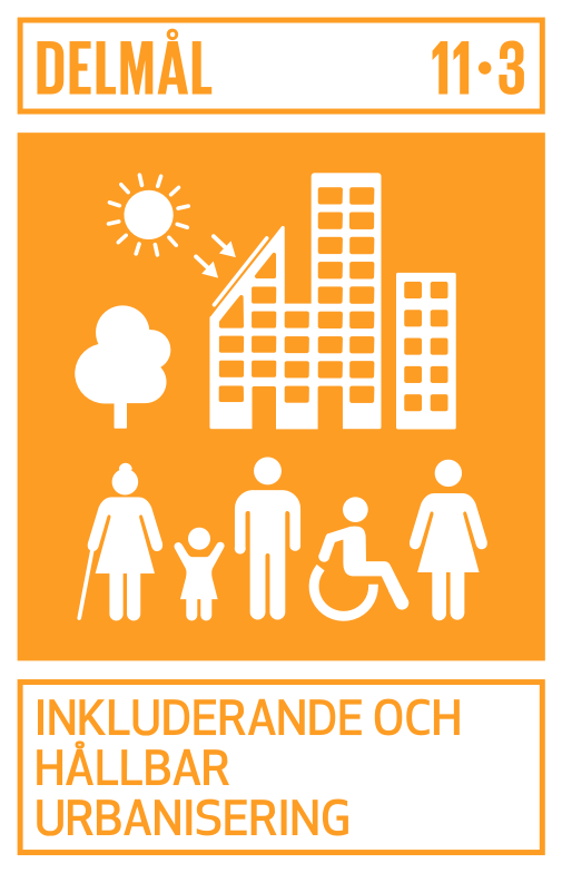
Read more about sub-goal 11.3 - Inclusive and sustainable urbanization.
An important piece of the puzzle in the work of landslide protection around Göta älv
An important work is currently underway to investigate how land around the Göta River can be landslide-proofed. A possible landslide would mean a disaster for, among others, the more than 700,000 people who currently have their drinking water source in Göta Älv.Lantmäteriet contributes to the work.
Daniel Dahlin is a surveyor at Lantmäteriet. For just over a year, he and a few other surveying colleagues have been working to assist the Swedish Geotechnical Institute (SGI) with information and other work that falls within the framework of government collaboration. For some time, SGI has investigated various forms of cooperation with the aim of landslide protection around the Göta River.
- Lantmäteriet's role right now, is to perform some preparatory work. We support SGI with information, materials and general reasoning that has to do with the landslide protection measures. We have also begun a commissioned work to investigate communities in a number of areas along the Göta River. It is likely that in these areas there may be a need for landslide prevention measures, says Daniel.
Prevents catastrophic consequences
There are many different ways of landslide protection of an area and the choice of measure is governed by what the land in the area looks like. For example, it could be about drilling into the ground and casting cement in long pillars that stabilize the ground and make it less likely to move in the event of a landslide.
- Without these measures, a landslide can lead to entire buildings collapsing into the river. Not only does this mean disaster for property owners, it can in the long run also have catastrophic consequences in the form of the water in the river becoming polluted. About 700,000 people get their drinking water from the river today. Agricultural land can also be destroyed if the land collapses or if the water floods, says Daniel.
An exciting job that provides skills development
The preparatory work around the Göta River is not only extremely important for the people who live around the river or own the land. It is also an exciting and competence-developing work.
- The contact and collaboration with SGI has made my role as a business surveyor more interesting. I have also learned a lot about geotechnics, for example, which has meant that I have also broadened my skills, says Daniel.
Read more about sub-goals 11.3 - Inclusive and sustainable urbanization.
Important data from a height
At regular intervals, various parts of Sweden are photographed and laser scanned, and our altitude data has many uses and is an important part of the planning of preventive measures in the event of climate change.
With the help of laser scanning from aircraft, Lantmäteriet has created a height model throughout Sweden. The elevation model consists of coordinate elevations in a regular grid. In combination with other geographical information, you can create three-dimensional models of the landscape. These models make it possible to predict the consequences of certain climate-related disasters, which in turn makes it possible to minimize the damage.
- In the event of a flood or extreme rainfall, our data can help create an idea of where the water is taking the road. It is crucial, for example, to assess which areas need to be decontaminated or protected when leaching a toxic area. It can also be important to assess areas that may be unsuitable to build, for example, a preschool or hospital, if you do not take special measures to protect against flooding, says Sven Vasseur, regional geodata coordinator.
A product with timeliness that is increasingly in demand
It is important that our height data is a product with timeliness. Reality changes if you build a bridge, for example, or if there are buildings of other kinds, and then we need to make new measurements to be able to update the height model.
- When it comes to laser scanning and aerial photography, it happens at regular intervals , and is greatly affected by technological developments. Cameras and sensors are getting better, which means that you can fly at higher altitudes and thus get data for more space, with at least as good quality. Current and reliable height data are increasingly in demand, and only Lantmäteriet produces this type of data nationally, says Sven.
A product with many uses
Lantmäteriet is sitting on a treasure trove of pictures. Historical images that stretch all the way back to the early 20th century.
- That we have images from different times can make it possible to see what happened to an area over time. Where are the remnants of old industries that can contribute to leaching of old landfills? That information may have been captured on our photos as a side effect of us taking aerial photographs to make maps, says Sven.
Another example is objects that are particularly worthy of protection, which testify to our cultural sites and can be identified in our height model, for example with machine learning.
- Our data becomes second- and third-hand use that can be used in many different ways. We did not imagine that use when we first generated our data, but it happens to be of such good quality that it can be used in other applications as well, says Sven.
We play a role
From building a new authority in Liberia that keeps track of ownership and sets boundaries, via address registers and improved measurement methods in Bosnia and Herzegovina, to slowly but surely change the culture of gender equality in Rwanda. Lantmäteriet efforts play a role and contributes to achieving the global sustainability goals.
Four employees within Lantmäteriet 's international unit are currently doing something that many of us others only dare to dream about. They have packed their bags and left Sweden, at least temporarily. They contribute and support, with their expertise, in some of the places in the world where the need for our help is greatest. One is stationed in Bosnia and Herzegovina, two in Liberia. and one in Rwanda to live, learn and experience mass for a few years while sharing their and Lantmäteriet's values, and experiences of building capacity in individuals and organizations.
In Bosnia and Herzegovina, where we have been active for many years, over the past year we have worked to clarify how our support helps our partner authorities and the country to achieve the global sustainability goals. Among other things, in these corona times, extensive telework has been carried out with digital tools, including workshops with Lantmäteriet 's risk and sustainability strategists.
An authority under construction in Liberia
Not too long ago, the Liberia Land Authority (LLA), the equivalent of the Lantmäteriet in Liberia, was started. In poor countries, land and ownership issues are central to conflict avoidance and vital to enable economic, social and democratic development. Lantmäteriet is therefore in place to support the development of the new authority and the land sector.
It is a team effort between us at home, our local employees, the people who are employed by the agency and other organizations and authorities as well as other donors in Liberia.
- We give them training and practical help to get their authority up and running so that they, in turn, can carry out their mission. We support them in organizational and structural issues, practical work, work processes, technical training and how the authority needs to act to be transparent and secure so that it is not just rich men who have the right to land. In Liberia, our support helps with, among other things, technical education for women, the work towards sub-goals 5.B (strengthen the role of women with the help of technology) and 4.3 (equal access to vocational education and higher education of good quality), says Kent Nilsson, International Unit.
We contribute to equal rights to financial resources and ownership
In Rwanda, everyone, whether you are a man or a woman, has the right to own land. On paper anyway, the reality is unfortunately not quite there yet.
- In Rwanda, with our seconded staff at the helm, we support a women's rights organization that works with women's rights in general, but specifically in land issues. We inform about the land laws in Rwanda and the rights that women have. They have a culture of gender equality that, compared to some other developing countries, has come a long way but has a lot left in practice. We help to change slowly but surely, says Kent.
Occasionally, large village meetings, district meetings and so-called "land weeks" are also organized, where Rwanda's equivalent of Lantmäteriet (RLMUA, Rwanda Land Management and Use Authority), together with, for example, women's organizations and banks, informs about rights and helps to answer questions related to land and ownership.
- Everything we do in the projects contributes to Agenda 2030 and that developing countries must achieve the sustainability goals, says Kent. Depending on the countries' priorities and needs and the focus of the projects, we contribute to different goals and sub-goals to varying degrees. An example is Rwanda, where our support with education, practical work and information campaigns helps work towards, among other things, sub-goals 5.A (equal right to financial resources and ownership and access to financial services) and 16.6 (building efficient, reliable and transparent institutions).
Sustainability in Bosnia and Herzegovina
Exports of services help to develop the authorities in Bosnia and Herzegovina (BaH) so that they can reform the land sector, among other things. a by establishing an address register, register for sales prices regarding properties, as well as reliable measurements (incl. height data) in real time.
In 2021, Lantmäteriets sustainability strategists together with representatives from the authorities in BaH analyzed which sub-goals in Agenda 2030 that the project's activities affect. For example, an effective measurement procedure in property development contributes to establishing a digital infrastructure and can then be linked to sub-goal 9.1 (Creating sustainable, resilient and inclusive infrastructure) but also sub-goal 17.18 (Support collection and dissemination of reliable data).
Lantmäteriet's risk and sustainability strategists conducted a workshop with representatives from BaH to begin a materiality analysis, which is a step towards working towards sub-goal 16.6 (Build efficient, reliable and transparent institutions). The task of the materiality analysis is to identify the authorities' strategic sustainability aspects.
We can state that Lantmäteriet 's work in the international projects is very much appreciated, does great good for the individuals and organizations we work with and contribute to achieving the global sustainability goals. This at the same time as our expatriates live, learn and experience lots that give them memories for life and unique experiences Lantmäteriet will benefit from for a long time.